
 by eiLink
Water supply for irrigation in Padarchol area: assessment of rainwater and groundwater potential
The framework of the project was to solve the problem of irrigation in the semi-arid area by evaluating the potential of subsurface freshwater reserves and the use of runoff water from surface flooding events.
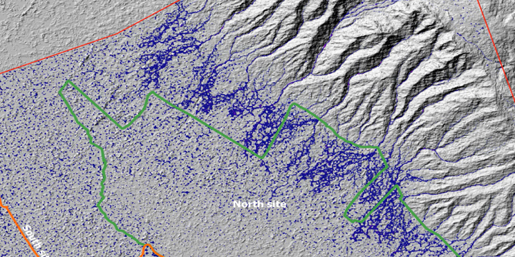
The projects’ objectives were the analysis of the soil and climate characteristics in terms of agriculture and surface water resources, using the Geographic Information System and climate and precipitation intensity data of the last 40 years of the semi-arid area, and the preliminary analysis of surface flows and flood events formed in the mountainous area. It consists of research work on the preparation of a 3D simulation model, the preliminary analysis of groundwater and the study of irrigation potential. The groundwater potential of the area was investigated considering the geological background of the surrounding area and logging data from several exploration wells available near the target area.
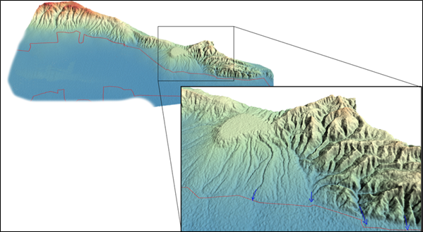
Significant water reserves have been found at depths below 300 meters. Due to the geological setting, the water is considered saline and unconfined, so the costs of new well drilling, water extraction using pumps, and desalination have been estimated. The chemical content of the runoff water coming from the nearby mud volcano is considered unsafe to use for irrigation purposes, and it is proposed to redirect the channels coming from that area, which will increase the productivity of the actual irrigation lands. A 3D topographical model as well as a flooding event simulation have been created by our team. According to our forecasting model, collecting water from flooding can provide irrigation water for 150 hectares of arable land. In order to collect rainwater, 5–6 ponds with a useful volume of 120–180 thousand cubic meters each should be created. The amount of average rain precipitation has been estimated and forecasted with detailed probability statistics. A system of catchment canals with a total length of 80 km should be established to direct rainwater to the ponds. Considering the geometry of the land, a flood water management map has been created.